
Make a donation
Gear up for your next adventure:
As an Amazon Associate, this site earns from qualifying purchases at no extra cost to you.
savannakhet topographic map
Click on the map to display elevation.
Make a donation
Gear up for your next adventure:
As an Amazon Associate, this site earns from qualifying purchases at no extra cost to you.
About this map
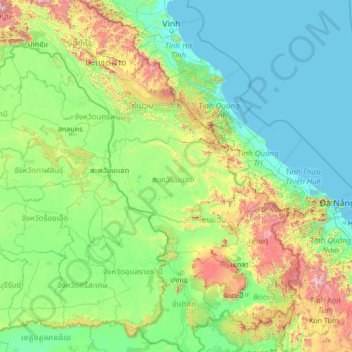
Name: savannakhet topographic map, elevation, terrain.
Location: savannakhet, Laos (13.94337 103.16035 19.14337 108.36035)
Average elevation: 896 ft
Minimum elevation: -3 ft
Maximum elevation: 8,625 ft
Make a donation
Gear up for your next adventure:
As an Amazon Associate, this site earns from qualifying purchases at no extra cost to you.
Other topographic maps
Click on a map to view its topography, its elevation and its terrain.
Sekong Province
The Dakchung Plateau is an Important Bird Area (IBA). It is 5,140 ha in size, and at an elevation of 800–1,400 metres (2,600–4,600 ft). The habitat is characterized as pine woodland, grassland, degraded semi-evergreen forest, dry evergreen forest, marshy land, and tall grasses areas. Of the avifauna, the…
Average elevation: 2,530 ft
Luang Namtha
The Nam Ha National Biodiversity Conservation Area (NBCA) has dense forest covering 90% of the area. May to September are the rainy months with average annual rainfall of 1,256 millimetres (49.4 in). December to February are the winter months with temperatures touching as low as 5 °C (41 °F). Heavy fog is…
Average elevation: 2,825 ft
Luang Prabang
The 60,070 hectare Phou Louey Massif Important Bird Area (IBA) is in the Nam Et-Phou Louey National Biodiversity Conservation Area (NBCA). The IBA is in the provinces of Luang Prabang and Houaphanh. It sits at an elevation of 700–1,800 metres (2,300–5,900 ft). The habitat contains mixed deciduous forest,…
Average elevation: 2,986 ft
Make a donation
Gear up for your next adventure:
As an Amazon Associate, this site earns from qualifying purchases at no extra cost to you.
Champasak Province
The Mekong Channel from Phou Xiang Thong to Siphandon Important Bird Area (IBA) is 34,200 ha (85,000 acres) in size. A portion of the IBA (10,000 hectares) overlaps with the 120,000 ha (300,000 acres) Phou Xieng Thong National Protected Area. The IBA encompasses two provinces, Champasak and Salavan. The IBA is…
Average elevation: 860 ft
Golden Triangle Special Economic Zone
Laos > Bokeo Province > Tonpheung District
Average elevation: 1,335 ft
Make a donation
Gear up for your next adventure:
As an Amazon Associate, this site earns from qualifying purchases at no extra cost to you.