Geolocate

Abbotsford topographic map

Click on the map to display elevation.

About this map

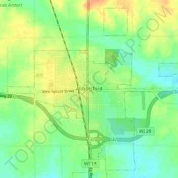
Name: Abbotsford topographic map, elevation, terrain.

Location: Abbotsford, Marathon County, Wisconsin, 54405, United States (44.92451 -90.34677 44.96784 -90.27950)

Average elevation: 1,401 ft

Minimum elevation: 1,348 ft

Maximum elevation: 1,473 ft

Marathon County trails, hiking, mountain biking, running and outdoor activities

Other topographic maps

Click on a map to view its topography, its elevation and its terrain.

Rib Falls

United States > Wisconsin > Marathon County

Average elevation: 1,293 ft

Ringle

United States > Wisconsin > Marathon County

Average elevation: 1,316 ft

Stack Island

United States > Wisconsin > Marathon County > Wausau

Average elevation: 1,316 ft

Rozellville

United States > Wisconsin > Marathon County

Average elevation: 1,240 ft

Gear up for your next adventure:

🔦Compact Flashlight - Reliable flashlight for emergencies
🔌Solar Panel Charger - Charge gear sustainably outdoors
🪄Magnetic Compass - Accurate compass for navigation
Backpacking Tent - Lightweight and durable tent for multi‑day hikes
📦Dry Bags Set - Waterproof storage for electronics and clothes

As an Amazon Associate, this site earns from qualifying purchases at no extra cost to you.