Geolocate

Northwest Angle 33 First Nation topographic map

Click on the map to display elevation.

About this map

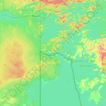
Name: Northwest Angle 33 First Nation topographic map, elevation, terrain.

Location: Northwest Angle 33 First Nation, Whitefish Bay, Kenora District, Northwestern Ontario, Ontario, Canada (49.34030 -95.05440 49.40138 -93.93548)

Average elevation: 1,089 ft

Minimum elevation: 1,037 ft

Maximum elevation: 1,325 ft

Gear up for your next adventure:

📶Satellite Messenger - Communication device off‑grid
🏕️Tent Footprint - Protect your tent base from wear
🩹Survival Bandages - High‑quality bandages for emergencies
🦶Carbon Trekking Poles - Reduce knee impact on steep descents with ultra-light poles
🧥Waterproof Jacket for Hiking - Breathable and rugged rain jacket for outdoor excursions

As an Amazon Associate, this site earns from qualifying purchases at no extra cost to you.