Geolocate

La Maria topographic map

Click on the map to display elevation.

About this map

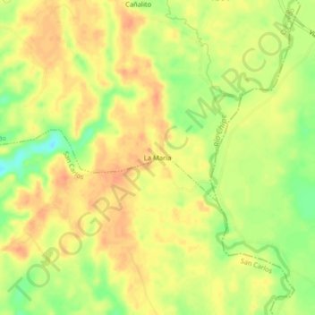
Name: La Maria topographic map, elevation, terrain.

Location: La Maria, Quevedo, Los Ríos, Ecuador (-1.06914 -79.42570 -1.02914 -79.38570)

Average elevation: 276 ft

Minimum elevation: 184 ft

Maximum elevation: 325 ft

Gear up for your next adventure:

🪵Folding Camp Saw - Compact saw for wood and campsite work
🧦Merino Wool Socks - Moisture-wicking, blister-preventing socks for long treks
🗻Climbing Gear Basics - Essential gear for beginner climbers
🌧️Backpack Rain Cover - Keep gear dry in wet weather
🥾Men's Hiking Boots - Durable, waterproof footwear for rugged terrain and steep inclines

As an Amazon Associate, this site earns from qualifying purchases at no extra cost to you.