Geolocate

Quevedo topographic maps

Click on a map to view its topography, its elevation and its terrain.

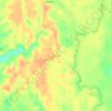
La Maria

Ecuador > Los Ríos > Quevedo > Quevedo

Average elevation: 276 ft

Gear up for your next adventure:

🛰️Satellite Messengers - Emergency SOS and two-way messaging for off-grid adventures
🧭Pro Hiking Compasses - High-accuracy liquid-filled compasses for topographic orientation
🚗GPS Dash Cams - Record your scenic drives through mountain passes and canyons
🧯Portable Fire Pit - Compact fire pit for camping spots
🦶Hiking Gaiters - Keep debris and water out of your boots

As an Amazon Associate, this site earns from qualifying purchases at no extra cost to you.