
Thank you for supporting this site ❤️
Make a donation
Make a donation
Gear up for your next adventure:
As an Amazon Associate, this site earns from qualifying purchases at no extra cost to you.
Bas-Intyamon topographic map
Click on the map to display elevation.
Thank you for supporting this site ❤️
Make a donation
Make a donation
Gear up for your next adventure:
As an Amazon Associate, this site earns from qualifying purchases at no extra cost to you.
About this map
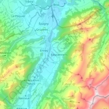
Name: Bas-Intyamon topographic map, elevation, terrain.
Location: Bas-Intyamon, Greyerzbezirk, Freiburg, Schweiz (46.53436 7.03417 46.59097 7.16686)
Average elevation: 3,770 ft
Minimum elevation: 2,231 ft
Maximum elevation: 7,789 ft
Thank you for supporting this site ❤️
Make a donation
Make a donation
Gear up for your next adventure:
As an Amazon Associate, this site earns from qualifying purchases at no extra cost to you.
Other topographic maps
Click on a map to view its topography, its elevation and its terrain.