Geolocate

Schotten topographic map

Click on the map to display elevation.

About this map

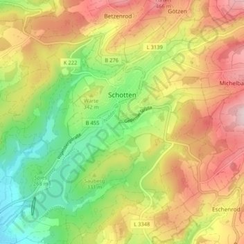
Name: Schotten topographic map, elevation, terrain.

Location: Schotten, Vogelsbergkreis, Hesse, 63679, Germany (50.47288 9.07730 50.51899 9.15763)

Average elevation: 1,106 ft

Minimum elevation: 623 ft

Maximum elevation: 1,631 ft

Other topographic maps

Click on a map to view its topography, its elevation and its terrain.

Dick

Germany > Hesse > Vogelsbergkreis

Average elevation: 1,240 ft

Lauterbach

Germany > Hesse > Vogelsbergkreis

Average elevation: 1,184 ft

Gear up for your next adventure:

🎒Trekking Poles - Sturdy poles for balance and stability on rough terrain
🔌Solar Panel Charger - Charge gear sustainably outdoors
🔦Compact Flashlight - Reliable flashlight for emergencies
📷Action Camera - Capture your outdoor adventures in HD
📦Gear Storage Bags - Organize and protect outdoor equipment

As an Amazon Associate, this site earns from qualifying purchases at no extra cost to you.