
仙踪镇 topographic map
Interactive map
Click on the map to display elevation.
About this map
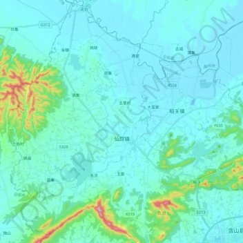
Name: 仙踪镇 topographic map, elevation, terrain.
Location: 仙踪镇, 含山县, 马鞍山市, 安徽省, 238100, 中国 (31.72767 117.89829 31.90612 118.05085)
Average elevation: 141 ft
Minimum elevation: 26 ft
Maximum elevation: 1,010 ft
Other topographic maps
Click on a map to view its topography, its elevation and its terrain.