Geolocate

Mengla topographic map

Click on the map to display elevation.

About this map
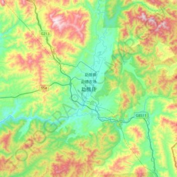
Name: Mengla topographic map, elevation, terrain.

Location: Mengla, Mengla County, Xishuangbanna, Yunnan, 666300, China (21.30185 101.40503 21.62185 101.72503)

Average elevation: 3,058 ft

Minimum elevation: 1,906 ft

Maximum elevation: 5,328 ft

Other topographic maps

Click on a map to view its topography, its elevation and its terrain.

Mohan

China > Yunnan > Mengla County

Average elevation: 3,156 ft

Gear up for your next adventure:

⛺Backpacking Tents - Weight-optimized shelters for multi-day topographic surveys
🔋Solar Power Banks - Keep your GPS and phone charged in remote wilderness areas
🩳Quick‑Dry Hiking Shorts - Comfortable and quick‑dry shorts for summer hiking
🔥Fast-Boil Camping Stoves - Efficient cooking systems for quick trail meals
🛡️Bear Spray Outdoor - Protection in bear country hikes

As an Amazon Associate, this site earns from qualifying purchases at no extra cost to you.