Geolocate

Mohan topographic map

Click on the map to display elevation.

About this map
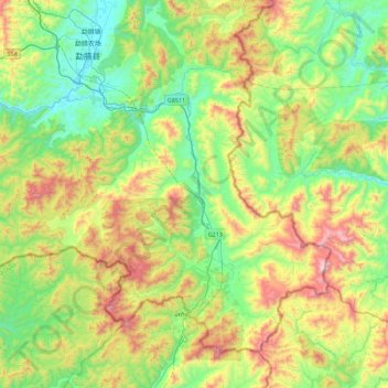
Name: Mohan topographic map, elevation, terrain.

Location: Mohan, Mengla County, Xishuangbanna, Yunnan, 666100, China (21.14314 101.39843 21.48218 101.84467)

Average elevation: 3,156 ft

Minimum elevation: 2,021 ft

Maximum elevation: 5,384 ft

Other topographic maps

Click on a map to view its topography, its elevation and its terrain.

Menglun

China > Yunnan > Mengla County

Average elevation: 2,195 ft

Mengla

China > Yunnan > Mengla County

Average elevation: 3,058 ft

Gear up for your next adventure:

🧤Hiking Gloves - Protective gloves for rugged trails
🔌Solar Panel Charger - Charge gear sustainably outdoors
🧭GPS Watch Accessories - Bands and chargers for GPS watches
🪶Survival Guide Book - Expert advice for emergency preparedness
💧Water Purification System - Clean water on the trail with reliable purifiers

As an Amazon Associate, this site earns from qualifying purchases at no extra cost to you.