Geolocate

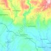
Lucena topographic map

Click on the map to display elevation.

About this map

Name: Lucena topographic map, elevation, terrain.

Location: Lucena, Prosperidad, Agusan del Sur, Caraga, 8500, Philippines (8.54682 125.85325 8.58682 125.89325)

Average elevation: 118 ft

Minimum elevation: 89 ft

Maximum elevation: 154 ft

Other topographic maps

Click on a map to view its topography, its elevation and its terrain.
Maug River

Philippines > Agusan del Sur > Prosperidad

Average elevation: 725 ft

Gear up for your next adventure:

💧Water Filtration Bottles - Safely drink from streams and lakes while exploring
🎒Hydration Pack - Hands‑free water reservoir for long hikes
🗃️Trail First Aid Kit - Essential kit for outdoor injuries and emergencies
📷Action Camera - Capture your outdoor adventures in HD
🧯Portable Fire Pit - Compact fire pit for camping spots

As an Amazon Associate, this site earns from qualifying purchases at no extra cost to you.