Geolocate

Corbin topographic map

Click on the map to display elevation.

About this map

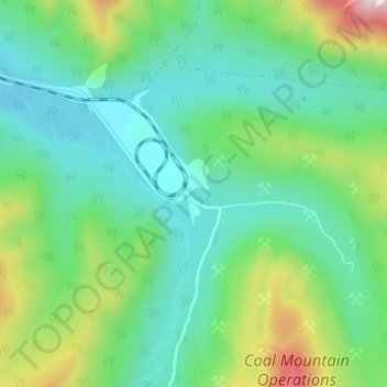
Name: Corbin topographic map, elevation, terrain.

Location: Corbin, Area A (Upper Flathead/Elk Valley), Regional District of East Kootenay, British Columbia, Canada (49.49748 -114.69572 49.53748 -114.65572)

Average elevation: 5,364 ft

Minimum elevation: 4,783 ft

Maximum elevation: 7,018 ft

Other topographic maps

Click on a map to view its topography, its elevation and its terrain.

Gear up for your next adventure:

🛠️Outdoor Gear Repair Kit - Essential tools to fix gear on the trail
🦶Hiking Gaiters - Keep debris and water out of your boots
🛡️Insect Repellent - Protection against bugs during outdoor activities
📡Handheld GPS Device - Reliable handheld GPS for outdoor navigation
📷Action Camera - Capture your outdoor adventures in HD

As an Amazon Associate, this site earns from qualifying purchases at no extra cost to you.