Geolocate

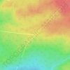
Chipman topographic map

Click on the map to display elevation.

About this map

Name: Chipman topographic map, elevation, terrain.

Location: Chipman, Chipman Parish, Municipality of Grand Lake, Queens County, New Brunswick, Canada (46.14311 -65.92265 46.19745 -65.84648)

Average elevation: 89 ft

Minimum elevation: -3 ft

Maximum elevation: 230 ft

Other topographic maps

Click on a map to view its topography, its elevation and its terrain.
Gear up for your next adventure:

🏕️Tent Footprint - Protect your tent base from wear
🧤Tactile Hiking Gloves - Keep hands warm while operating GPS and smartphone screens
📦Gear Storage Bags - Organize and protect outdoor equipment
🧦Hiking Socks - Comfortable socks to prevent blisters on long hikes
🧤Hiking Gloves - Protective gloves for rugged trails

As an Amazon Associate, this site earns from qualifying purchases at no extra cost to you.