
Town of Spooner topographic map
Interactive map
Click on the map to display elevation.
About this map
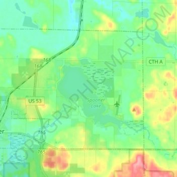
Name: Town of Spooner topographic map, elevation, terrain.
Average elevation: 1,122 ft
Minimum elevation: 1,033 ft
Maximum elevation: 1,329 ft
Other topographic maps
Click on a map to view its topography, its elevation and its terrain.
Devils Lake
United States > Wisconsin > Washburn County
Devils Lake, Town of Bass Lake, Washburn County, Wisconsin, United States
Average elevation: 1,204 ft
Tomahawk Lake
United States > Wisconsin > Washburn County
Tomahawk Lake, Town of Casey, Washburn County, Wisconsin, United States
Average elevation: 1,043 ft
Slim Lake
United States > Wisconsin > Washburn County
Slim Lake, Town of Birchwood, Washburn County, Wisconsin, United States
Average elevation: 1,325 ft
Chicog Lake
United States > Wisconsin > Washburn County
Chicog Lake, Town of Chicog, Washburn County, Wisconsin, United States
Average elevation: 1,030 ft
Spooner
United States > Wisconsin > Washburn County
Spooner, Washburn County, Wisconsin, United States
Average elevation: 1,102 ft
Town of Chicog
United States > Wisconsin > Washburn County
Town of Chicog, Washburn County, Wisconsin, United States
Average elevation: 1,017 ft
Minong
United States > Wisconsin > Washburn County
Minong, Washburn County, Wisconsin, United States
Average elevation: 1,083 ft
Crystal Mountain
United States > Wisconsin > Washburn County
Crystal Mountain, Town of Spooner, Washburn County, Wisconsin, United States
Average elevation: 1,129 ft
Shell Lake
United States > Wisconsin > Washburn County
Shell Lake, Washburn County, Wisconsin, 53871, United States
Average elevation: 1,234 ft
Stone Lake
United States > Wisconsin > Washburn County
Stone Lake, Town of Stone Lake, Washburn County, Wisconsin, 54876, United States
Average elevation: 1,329 ft