Geolocate

Bethany topographic map

Click on the map to display elevation.

About this map

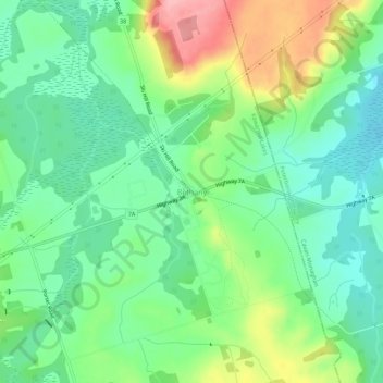
Name: Bethany topographic map, elevation, terrain.

Location: Bethany, Kawartha Lakes, Central Ontario, Ontario, Canada (44.16258 -78.58679 44.20258 -78.54679)

Average elevation: 889 ft

Minimum elevation: 735 ft

Maximum elevation: 1,191 ft

Other topographic maps

Click on a map to view its topography, its elevation and its terrain.

Head Lake

Canada > Ontario > Kawartha Lakes

Average elevation: 912 ft

Pigeon River

Canada > Ontario > Kawartha Lakes > Omemee

Average elevation: 850 ft

Dalrymple Lake

Canada > Ontario > Kawartha Lakes

Average elevation: 791 ft

Sturgeon Lake

Canada > Ontario > Kawartha Lakes

Average elevation: 873 ft

Emily Provincial Park

Canada > Ontario > Kawartha Lakes

Average elevation: 850 ft

Young Lake

Canada > Ontario > Kawartha Lakes

Average elevation: 758 ft

Four Mile Lake

Canada > Ontario > Kawartha Lakes

Average elevation: 925 ft

Cameron Lake

Canada > Ontario > Kawartha Lakes > Fenelon Falls

Average elevation: 860 ft

Victoria Lake

Canada > Ontario > Kawartha Lakes

Average elevation: 1,010 ft

Gear up for your next adventure:

🧣Merino Neck Gaiters - Multi-functional headwear for wind and sun protection
📡Handheld GPS Device - Reliable handheld GPS for outdoor navigation
🦶Carbon Trekking Poles - Reduce knee impact on steep descents with ultra-light poles
🔥Camping Stove - Portable stove for camping and backcountry cooking
🧯Emergency Survival Kit - All‑in‑one survival essentials for the backcountry

As an Amazon Associate, this site earns from qualifying purchases at no extra cost to you.