Geolocate

Beilngries topographic map

Click on the map to display elevation.

About this map
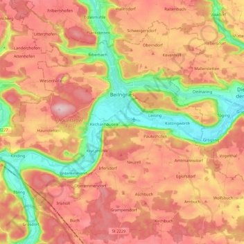
Name: Beilngries topographic map, elevation, terrain.

Location: Beilngries, Landkreis Eichstätt, Bavaria, 92339, Germany (48.95162 11.38549 49.08770 11.59514)

Average elevation: 1,575 ft

Minimum elevation: 1,175 ft

Maximum elevation: 1,886 ft

Gear up for your next adventure:

🦺Reflective Outdoor Gear - Safety gear for low‑light conditions
🔭Compact Binoculars - HD vision for scouting terrain and identifying distant landmarks
🗺️NatGeo Topo Maps - High-quality waterproof printed topographic maps of US Parks
🎒Day Hiking Backpack - Lightweight backpack perfect for day trips and outdoor adventures
📚Navigation Handbooks - Master the art of reading topographic maps and using a compass

As an Amazon Associate, this site earns from qualifying purchases at no extra cost to you.