Geolocate

Cacouna topographic map

Click on the map to display elevation.

About this map
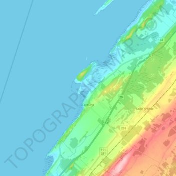
Name: Cacouna topographic map, elevation, terrain.

Location: Cacouna, Rivière-du-Loup (MRC), Bas-Saint-Laurent, Quebec, G0L 1G0, Canada (47.86165 -69.53398 47.99850 -69.38242)

Average elevation: 95 ft

Minimum elevation: -3 ft

Maximum elevation: 512 ft

Other topographic maps

Click on a map to view its topography, its elevation and its terrain.

Lac A

Canada > Quebec > Rivière-du-Loup (MRC) > Saint-Modeste

Average elevation: 659 ft

Gear up for your next adventure:

🪶Fire Starter Kit - Reliable fire starter for survival and camping
🛠️Backpacking Tool Kit - Essential toolkit for outdoor repairs
📚USA Hiking Guide Books - Top trail guides and map books
🎒Gear Packing Cubes - Organize your backpack efficiently
🌧️Backpack Rain Cover - Keep gear dry in wet weather

As an Amazon Associate, this site earns from qualifying purchases at no extra cost to you.