Geolocate

Wharton topographic map

Click on the map to display elevation.

About this map

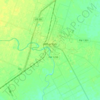
Name: Wharton topographic map, elevation, terrain.

Location: Wharton, Wharton County, Texas, 77488, United States (29.24389 -96.16223 29.36660 -96.05993)

Average elevation: 102 ft

Minimum elevation: 79 ft

Maximum elevation: 125 ft

Other topographic maps

Click on a map to view its topography, its elevation and its terrain.

Lane City

United States > Texas > Wharton County

Average elevation: 89 ft

Pierce

United States > Texas > Wharton County > Pierce

Average elevation: 105 ft

Gear up for your next adventure:

🌎3D Topographic Globes - Raised relief globes for a tactile understanding of geography
🛰️Satellite Messengers - Emergency SOS and two-way messaging for off-grid adventures
🦶Hiking Gaiters - Keep debris and water out of your boots
🔋Solar Power Banks - Keep your GPS and phone charged in remote wilderness areas
🥘Titanium Cookware - Durable, featherlight pots and pans for backpacking

As an Amazon Associate, this site earns from qualifying purchases at no extra cost to you.