
Town of Vestal topographic map
Interactive map
Click on the map to display elevation.
About this map
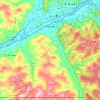
Name: Town of Vestal topographic map, elevation, terrain.
Location: Town of Vestal, Broome County, New York, United States (41.99890 -76.10900 42.11503 -75.94508)
Average elevation: 1,220 ft
Minimum elevation: 791 ft
Maximum elevation: 1,860 ft
Broome County trails, hiking, mountain biking, running and outdoor activities
Other topographic maps
Click on a map to view its topography, its elevation and its terrain.
Crocker Island
United States > New York > Broome County > Village of Johnson City
Average elevation: 1,348 ft