Geolocate

Kaliningrad topographic map

Click on the map to display elevation.

About this map

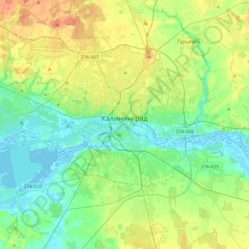
Name: Kaliningrad topographic map, elevation, terrain.

Location: Kaliningrad, Northwestern Federal District, Russia (54.63062 20.29328 54.77868 20.65380)

Average elevation: 62 ft

Minimum elevation: -23 ft

Maximum elevation: 190 ft

Gear up for your next adventure:

🛶Inflatable Kayak - Portable kayak for rivers, lakes, and expeditions
🛏️Cold Weather Sleeping Bag - Warm sleeping bag for cold conditions
🗺️Topographic Maps - Detailed topo maps for hiking, exploring and outdoor navigation
🔭Compact Binoculars - HD vision for scouting terrain and identifying distant landmarks
🔌Solar Panel Charger - Charge gear sustainably outdoors

As an Amazon Associate, this site earns from qualifying purchases at no extra cost to you.