
Umling topographic map
Click on the map to display elevation.
About this map
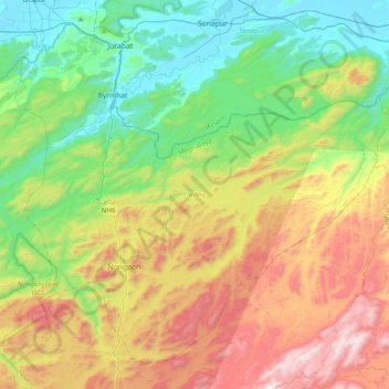
Name: Umling topographic map, elevation, terrain.
Location: Umling, Ri-Bhoi, Meghalaya, India (25.80998 91.75996 26.11817 92.15113)
Average elevation: 1,549 ft
Minimum elevation: 164 ft
Maximum elevation: 4,009 ft
Other topographic maps
Click on a map to view its topography, its elevation and its terrain.