Geolocate

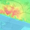
Wohldorf topographic map

Click on the map to display elevation.

About this map

Name: Wohldorf topographic map, elevation, terrain.

Location: Wohldorf, Wohldorf-Ohlstedt, Wandsbek, Hamburg, 22397, Duitsland (53.70068 10.12239 53.72068 10.14239)

Average elevation: 75 ft

Minimum elevation: 30 ft

Maximum elevation: 108 ft

Other topographic maps

Click on a map to view its topography, its elevation and its terrain.
Marienthal

Duitsland > Hamburg

Average elevation: 56 ft

Blankenese

Duitsland > Hamburg

Average elevation: 95 ft

Gear up for your next adventure:

📌Outdoor GPS Map App - Apps and devices for digital topographic navigation
🧤Tactile Hiking Gloves - Keep hands warm while operating GPS and smartphone screens
🦶Hiking Gaiters - Keep debris and water out of your boots
📚Navigation Handbooks - Master the art of reading topographic maps and using a compass
🔊Portable Camp Speaker - Music and alerts at camp

As an Amazon Associate, this site earns from qualifying purchases at no extra cost to you.