Geolocate

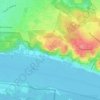
Blankenese topographic map

Click on the map to display elevation.

About this map

Name: Blankenese topographic map, elevation, terrain.

Location: Blankenese, Altona, Hamburg, 22587, Duitsland (53.55080 9.76177 53.57425 9.82669)

Average elevation: 95 ft

Minimum elevation: -7 ft

Maximum elevation: 292 ft

Other topographic maps

Click on a map to view its topography, its elevation and its terrain.
Waseberg

Duitsland > Hamburg

Average elevation: 108 ft

Tafelberg

Duitsland > Hamburg

Average elevation: 85 ft

Wohldorf

Duitsland > Hamburg

Average elevation: 75 ft

Gear up for your next adventure:

🚁Photography Drones - Capture stunning aerial views of landforms and topography
📌Outdoor GPS Map App - Apps and devices for digital topographic navigation
🛏️Cold Weather Sleeping Bag - Warm sleeping bag for cold conditions
🩹Survival Bandages - High‑quality bandages for emergencies
👖Convertible Hiking Pants - Versatile zip-off pants for changing altitudes and temperatures

As an Amazon Associate, this site earns from qualifying purchases at no extra cost to you.