
Clarkston Heights-Vineland topographic map
Interactive map
Click on the map to display elevation.
About this map
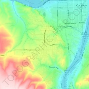
Name: Clarkston Heights-Vineland topographic map, elevation, terrain.
Average elevation: 1,083 ft
Minimum elevation: 712 ft
Maximum elevation: 1,765 ft
Other topographic maps
Click on a map to view its topography, its elevation and its terrain.
Anatone
United States > Washington > Asotin County
Anatone, Asotin County, Washington, United States
Average elevation: 3,599 ft
Asotin
United States > Washington > Asotin County
Asotin, Asotin County, Washington, 99402, United States
Average elevation: 1,047 ft
Clarkston
United States > Washington > Asotin County
Clarkston, Asotin County, Washington, United States
Average elevation: 807 ft