
Anatone topographic map
Click on the map to display elevation.
About this map
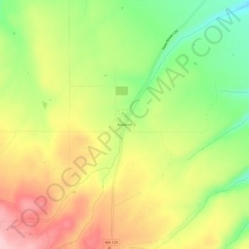
Name: Anatone topographic map, elevation, terrain.
Location: Anatone, Asotin County, Washington, United States (46.11479 -117.15230 46.15479 -117.11230)
Average elevation: 3,599 ft
Minimum elevation: 3,287 ft
Maximum elevation: 3,911 ft
Asotin County trails, hiking, mountain biking, running and outdoor activities
Other topographic maps
Click on a map to view its topography, its elevation and its terrain.
Asotin
United States > Washington > Asotin County
Asotin is located south of Clarkston, on the west bank of the Snake River. The elevation is 801 feet (244 m) above sea level.
Average elevation: 1,047 ft