
East Weymouth topographic map
Interactive map
Click on the map to display elevation.
About this map
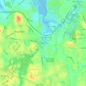
Name: East Weymouth topographic map, elevation, terrain.
Average elevation: 69 ft
Minimum elevation: -7 ft
Maximum elevation: 177 ft
Norfolk County trails, hiking, mountain biking, running and outdoor activities
Other topographic maps
Click on a map to view its topography, its elevation and its terrain.
Boston Harbor Islands National Recreation Area
United States > Massachusetts > Norfolk County > Weymouth
Average elevation: 3 ft