
Milford Sound topographic map
Click on the map to display elevation.
About this map
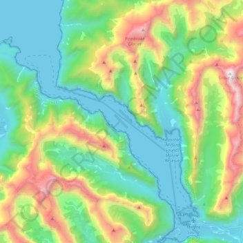
Name: Milford Sound topographic map, elevation, terrain.
Average elevation: 2,149 ft
Minimum elevation: -7 ft
Maximum elevation: 7,211 ft
Other topographic maps
Click on a map to view its topography, its elevation and its terrain.
Sutherland Falls
New Zealand > Southland > Southland District > Fiordland Community
Average elevation: 3,301 ft
Mount Mackenzie
New Zealand > Southland > Southland District > Fiordland Community
Average elevation: 3,839 ft
Misty River
New Zealand > Southland > Southland District > Fiordland Community
Average elevation: 1,240 ft
Manapouri
New Zealand > Southland > Southland District > Fiordland Community > Manapouri
Average elevation: 699 ft
Turner Falls
New Zealand > Southland > Southland District > Fiordland Community
Average elevation: 4,380 ft