Geolocate

21st district topographic map

Click on the map to display elevation.

About this map

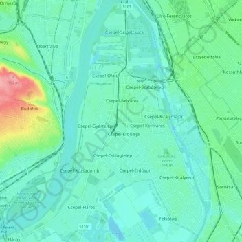
Name: 21st district topographic map, elevation, terrain.

Location: 21st district, Budapest, Central Hungary, Hungary (47.38493 19.01895 47.46193 19.10914)

Average elevation: 361 ft

Minimum elevation: 292 ft

Maximum elevation: 636 ft

Other topographic maps

Click on a map to view its topography, its elevation and its terrain.

Háros-sziget

Hungary > Budapest

Average elevation: 522 ft

Danube

Hungary > Budapest

Average elevation: 410 ft

Gear up for your next adventure:

🔊Portable Camp Speaker - Music and alerts at camp
🛠️Backpacking Tool Kit - Essential toolkit for outdoor repairs
🛰️Handheld GPS Units - Professional satellite navigators for precise backcountry mapping
📚USA Hiking Guide Books - Top trail guides and map books
🥾Hiking Shoes - Durable and comfortable shoes for trail hiking

As an Amazon Associate, this site earns from qualifying purchases at no extra cost to you.