
Make a donation
Gear up for your next adventure:
As an Amazon Associate, this site earns from qualifying purchases at no extra cost to you.
Háros-sziget topographic map
Click on the map to display elevation.
Make a donation
Gear up for your next adventure:
As an Amazon Associate, this site earns from qualifying purchases at no extra cost to you.
About this map
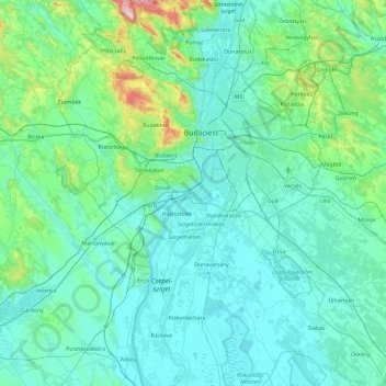
Name: Háros-sziget topographic map, elevation, terrain.
Location: Háros-sziget, Budapest, Central Hungary, 1777, Hungary (47.07615 18.70174 47.71615 19.34174)
Average elevation: 522 ft
Minimum elevation: 295 ft
Maximum elevation: 2,461 ft
Make a donation
Gear up for your next adventure:
As an Amazon Associate, this site earns from qualifying purchases at no extra cost to you.
Other topographic maps
Click on a map to view its topography, its elevation and its terrain.
Budapest
The wide Danube was always fordable at this point because of a small number of islands in the middle of the river. The city has marked topographical contrasts: Buda is built on the higher river terraces and hills of the western side, while the considerably larger Pest spreads out on a flat and featureless sand…
Average elevation: 502 ft
Make a donation
Gear up for your next adventure:
As an Amazon Associate, this site earns from qualifying purchases at no extra cost to you.
Make a donation
Gear up for your next adventure:
As an Amazon Associate, this site earns from qualifying purchases at no extra cost to you.