
Thank you for supporting this site ❤️
Make a donation
Make a donation
Gear up for your next adventure:
As an Amazon Associate, this site earns from qualifying purchases at no extra cost to you.
Gathigiriri topographic map
Click on the map to display elevation.
Thank you for supporting this site ❤️
Make a donation
Make a donation
Gear up for your next adventure:
As an Amazon Associate, this site earns from qualifying purchases at no extra cost to you.
About this map
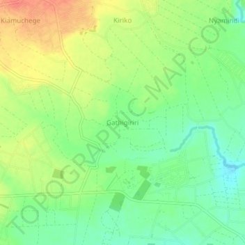
Name: Gathigiriri topographic map, elevation, terrain.
Location: Gathigiriri, Mwea East, Kirinyaga County, 10303, Kenya (-0.70330 37.38000 -0.66330 37.42000)
Average elevation: 3,714 ft
Minimum elevation: 3,638 ft
Maximum elevation: 3,799 ft
Thank you for supporting this site ❤️
Make a donation
Make a donation
Gear up for your next adventure:
As an Amazon Associate, this site earns from qualifying purchases at no extra cost to you.
Other topographic maps
Click on a map to view its topography, its elevation and its terrain.