Geolocate

Hodson topographic map

Click on the map to display elevation.

About this map

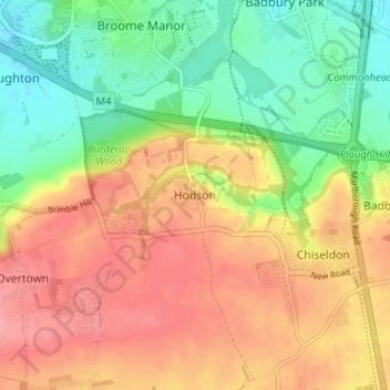
Name: Hodson topographic map, elevation, terrain.

Location: Hodson, Swindon, England, SN4 0QG, United Kingdom (51.50249 -1.77089 51.54249 -1.73089)

Average elevation: 486 ft

Minimum elevation: 335 ft

Maximum elevation: 630 ft

Other topographic maps

Click on a map to view its topography, its elevation and its terrain.

Highworth

United Kingdom > England > Swindon

Average elevation: 318 ft

Shaftsbury Lakes

United Kingdom > England > Swindon

Average elevation: 354 ft

Hannington

United Kingdom > England > Swindon

Average elevation: 289 ft

Blunsdon

United Kingdom > England > Swindon > Broad Blunsdon

Average elevation: 361 ft

Stratton St. Margaret

United Kingdom > England > Swindon > Swindon

Average elevation: 354 ft

Wroughton

United Kingdom > England > Swindon

Average elevation: 502 ft

South Marston

United Kingdom > England > Swindon

Average elevation: 331 ft

Wanborough

United Kingdom > England > Swindon

Average elevation: 456 ft

Chiseldon

United Kingdom > England > Swindon

Average elevation: 561 ft

Liddington

United Kingdom > England > Swindon > Liddington

Average elevation: 564 ft

Inglesham

United Kingdom > England > Swindon

Average elevation: 253 ft

Haydon Wick

United Kingdom > England > Swindon

Average elevation: 341 ft

Wroughton

United Kingdom > England > Swindon

Average elevation: 502 ft

Wroughton

United Kingdom > England > Swindon

Average elevation: 502 ft

Gear up for your next adventure:

💧Water Filtration Bottles - Safely drink from streams and lakes while exploring
🪶Camp Gear Gift Set - Perfect gift bundle for outdoor fans
📷Action Cameras - Rugged cameras to document your journeys across rugged terrain
🌲Outdoor Survival Books - Best books on survival skills
🎒Trekking Poles - Sturdy poles for balance and stability on rough terrain

As an Amazon Associate, this site earns from qualifying purchases at no extra cost to you.