Geolocate

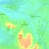
Langport topographic map

Click on the map to display elevation.

About this map

Name: Langport topographic map, elevation, terrain.

Location: Langport, Somerset, England, United Kingdom (51.03474 -2.83852 51.04492 -2.82021)

Average elevation: 59 ft

Minimum elevation: 7 ft

Maximum elevation: 249 ft

Other topographic maps

Click on a map to view its topography, its elevation and its terrain.
Chard

United Kingdom > England > Somerset

Chard is a town and a civil parish in the English county of Somerset. It lies on the A30 road near the Devon and Dorset borders, 15 miles (24 km) south west of Yeovil. The parish has a population of approximately 14,000 and, at an elevation of 121 metres (397 ft), Chard is the southernmost and one of the…

Average elevation: 443 ft
Charlton Mackrell

United Kingdom > England > Somerset

Average elevation: 138 ft

Ashington

United Kingdom > England > Somerset

Average elevation: 82 ft

Bird Pond

United Kingdom > England > Somerset > Brompton Regis > Hartford

Average elevation: 830 ft

Knott Oak

United Kingdom > England > Somerset > Ilminster

Average elevation: 210 ft

Aller

United Kingdom > England > Somerset > South Somerset

Average elevation: 92 ft

Shurton

United Kingdom > England > Somerset > Stogursey

Average elevation: 85 ft

Low Ham

United Kingdom > England > Somerset > High Ham

Average elevation: 148 ft

Gear up for your next adventure:

🧭Hiking Compass - Precision compass for reliable navigation in the wilderness
🧭GPS Watch Accessories - Bands and chargers for GPS watches
🎁Geography Themed Gifts - Unique gift ideas for map lovers and geography enthusiasts
🛰️Handheld GPS Units - Professional satellite navigators for precise backcountry mapping
🍳Camping Cook Set - Complete cookware for outdoor meals

As an Amazon Associate, this site earns from qualifying purchases at no extra cost to you.