
Thank you for supporting this site ❤️
Make a donation
Make a donation
Gear up for your next adventure:
As an Amazon Associate, this site earns from qualifying purchases at no extra cost to you.
Houdeng-Gœgnies topographic map
Click on the map to display elevation.
Thank you for supporting this site ❤️
Make a donation
Make a donation
Gear up for your next adventure:
As an Amazon Associate, this site earns from qualifying purchases at no extra cost to you.
About this map
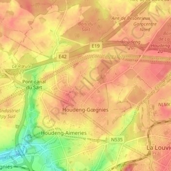
Name: Houdeng-Gœgnies topographic map, elevation, terrain.
Location: Houdeng-Gœgnies, La Louvière, Hainaut, Wallonia, 7100, Belgium (50.47388 4.13766 50.51336 4.19811)
Average elevation: 384 ft
Minimum elevation: 230 ft
Maximum elevation: 463 ft
Thank you for supporting this site ❤️
Make a donation
Make a donation
Gear up for your next adventure:
As an Amazon Associate, this site earns from qualifying purchases at no extra cost to you.
Other topographic maps
Click on a map to view its topography, its elevation and its terrain.
Houdeng-Gœgnies
Belgium > Hainaut > La Louvière > La Louvière > Houdeng-Gœgnies
Average elevation: 377 ft