
Sedgefield topographic map
Click on the map to display elevation.
About this map
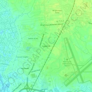
Name: Sedgefield topographic map, elevation, terrain.
Average elevation: 26 ft
Minimum elevation: 0 ft
Maximum elevation: 46 ft
New Hanover County trails, hiking, mountain biking, running and outdoor activities
Other topographic maps
Click on a map to view its topography, its elevation and its terrain.
Murraysville
United States > North Carolina > New Hanover County > Murraysville
Average elevation: 39 ft