Maize topographic map
Interactive map
Click on the map to display elevation.
About this map
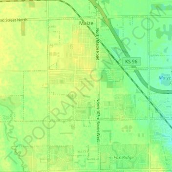
Name: Maize topographic map, elevation, terrain.
Location: Maize, Sedgwick County, Kansas, United States (37.73675 -97.49383 37.78572 -97.43566)
Average elevation: 1,358 ft
Minimum elevation: 1,322 ft
Maximum elevation: 1,378 ft
Maize is located at 37°46′45″N 97°28′2″W / 37.77917°N 97.46722°W / 37.77917; -97.46722 (37.779178, -97.467267) at an elevation of 1,348 feet (411 m). It lies on the west side of Big Slough Creek roughly 3 miles (4.8 km) southwest of the Arkansas River in the Wellington-McPherson Lowlands region of the Great Plains. Located in south-central Kansas, Maize is on K-96 immediately northwest of Wichita.
Other topographic maps
Click on a map to view its topography, its elevation and its terrain.
Wichita
United States > Kansas > Sedgwick County
Wichita, Sedgwick County, Kansas, United States
Average elevation: 1,339 ft
Colwich
United States > Kansas > Sedgwick County
Colwich, Sedgwick County, Kansas, United States
Average elevation: 1,381 ft
Mulvane
United States > Kansas > Sedgwick County
Mulvane, Sedgwick County, Kansas, 67110, United States
Average elevation: 1,266 ft
Wichita
United States > Kansas > Sedgwick County > Wichita
Wichita, Sedgwick County, Kansas, 67202, United States
Average elevation: 1,345 ft
Andale
United States > Kansas > Sedgwick County
Andale, Sedgwick County, Kansas, United States
Average elevation: 1,444 ft
Kechi
United States > Kansas > Sedgwick County
Kechi, Sedgwick County, Kansas, United States
Average elevation: 1,407 ft
Garden Plain
United States > Kansas > Sedgwick County
Garden Plain, Sedgwick County, Kansas, United States
Average elevation: 1,457 ft
Bel Aire
United States > Kansas > Sedgwick County
Bel Aire, Sedgwick County, Kansas, United States
Average elevation: 1,391 ft
Valley Center
United States > Kansas > Sedgwick County
Valley Center, Sedgwick County, Kansas, United States
Average elevation: 1,355 ft
Park City
United States > Kansas > Sedgwick County
Park City, Sedgwick County, Kansas, United States
Average elevation: 1,381 ft
Haysville
United States > Kansas > Sedgwick County
Haysville, Riverside Township, Sedgwick County, Kansas, United States
Average elevation: 1,273 ft
Minneha
United States > Kansas > Sedgwick County > Wichita
Minneha, Wichita, Sedgwick County, Kansas, 67206, United States
Average elevation: 1,388 ft
Valley Center
United States > Kansas > Sedgwick County > Valley Center > Valley Center
Valley Center, Sedgwick County, Kansas, United States
Average elevation: 1,362 ft
Derby
United States > Kansas > Sedgwick County
Derby, Sedgwick County, Kansas, 67037, United States
Average elevation: 1,289 ft
Mount Hope
United States > Kansas > Sedgwick County > Mount Hope
Mount Hope, Sedgwick County, Kansas, United States
Average elevation: 1,440 ft