
Thank you for supporting this site ❤️
Make a donation
Make a donation
Gear up for your next adventure:
As an Amazon Associate, this site earns from qualifying purchases at no extra cost to you.
Thamesford topographic map
Click on the map to display elevation.
Thank you for supporting this site ❤️
Make a donation
Make a donation
Gear up for your next adventure:
As an Amazon Associate, this site earns from qualifying purchases at no extra cost to you.
About this map
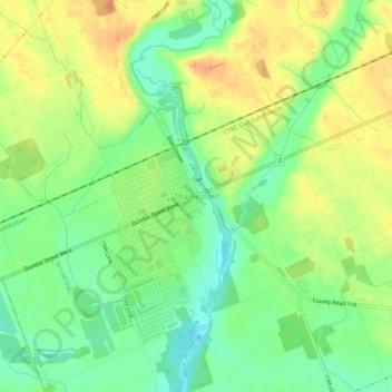
Name: Thamesford topographic map, elevation, terrain.
Location: Thamesford, Zorra, Oxford County, Ontario, N0M 2M0, Canada (43.03889 -81.01631 43.07889 -80.97631)
Average elevation: 955 ft
Minimum elevation: 889 ft
Maximum elevation: 1,024 ft
Thank you for supporting this site ❤️
Make a donation
Make a donation
Gear up for your next adventure:
As an Amazon Associate, this site earns from qualifying purchases at no extra cost to you.