
Naches topographic map
Click on the map to display elevation.
About this map
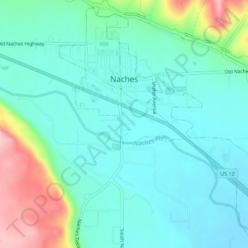
Name: Naches topographic map, elevation, terrain.
Location: Naches, Yakima County, Washington, United States (46.71429 -120.71086 46.74001 -120.66792)
Average elevation: 1,568 ft
Minimum elevation: 1,407 ft
Maximum elevation: 2,034 ft
Yakima County trails, hiking, mountain biking, running and outdoor activities
Other topographic maps
Click on a map to view its topography, its elevation and its terrain.
Mount Adams
United States > Washington > Yakima County
Adams is one of the long-lived volcanoes in the Cascade Range, with minor activity beginning 900,000 years ago and major cone building activity beginning 520,000 years ago. The whole mountain has been completely eroded by glaciers to an elevation of 8,200 feet (2,500 m) twice during its lifetime. The current…
Average elevation: 10,614 ft
Mount Adams
United States > Washington > Yakima County
The mountain is home to diverse ecological zones, ranging from dense lower-elevation forests dominated by Douglas fir and western hemlock on its western slopes to drier ponderosa pine forests on its eastern slopes. These ecosystems support a rich array of flora and fauna, including large mammals like Roosevelt…
Average elevation: 10,614 ft
Mount Adams
United States > Washington > Yakima County
Adams is one of the long-lived volcanoes in the Cascade Range, with minor activity beginning 900,000 years ago and major cone building activity beginning 520,000 years ago. The whole mountain has been completely eroded by glaciers to an elevation of 8,200 feet (2,500 m) twice during its lifetime. The current…
Average elevation: 10,614 ft