
Thank you for supporting this site ❤️
Make a donation
Make a donation
Gear up for your next adventure:
As an Amazon Associate, this site earns from qualifying purchases at no extra cost to you.
Satyawati topographic map
Click on the map to display elevation.
Thank you for supporting this site ❤️
Make a donation
Make a donation
Gear up for your next adventure:
As an Amazon Associate, this site earns from qualifying purchases at no extra cost to you.
About this map
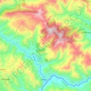
Name: Satyawati topographic map, elevation, terrain.
Location: Satyawati, Gulmi, Nepal (27.96399 83.38330 28.09608 83.54984)
Average elevation: 4,137 ft
Minimum elevation: 1,526 ft
Maximum elevation: 8,317 ft
Thank you for supporting this site ❤️
Make a donation
Make a donation
Gear up for your next adventure:
As an Amazon Associate, this site earns from qualifying purchases at no extra cost to you.