
Ainaro topographic map
Interactive map
Click on the map to display elevation.
About this map
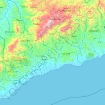
Name: Ainaro topographic map, elevation, terrain.
Location: Ainaro, East Timor (-9.45408 125.32584 -8.76925 125.84335)
Average elevation: 1,506 ft
Minimum elevation: -3 ft
Maximum elevation: 9,478 ft
Other topographic maps
Click on a map to view its topography, its elevation and its terrain.