
Ainaro topographic map
Interactive map
Click on the map to display elevation.
About this map
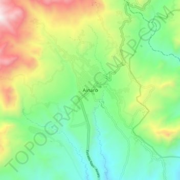
Name: Ainaro topographic map, elevation, terrain.
Location: Ainaro, East Timor (-9.03690 125.46482 -8.95690 125.54482)
Average elevation: 2,946 ft
Minimum elevation: 1,263 ft
Maximum elevation: 6,152 ft
Other topographic maps
Click on a map to view its topography, its elevation and its terrain.