Geolocate

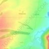
Severny topographic map

Click on the map to display elevation.

About this map

Name: Severny topographic map, elevation, terrain.

Location: Severny, Краснокутское сельское поселение, Mostovsky District, Krasnodar Krai, Southern Federal District, 352591, Russia (44.62631 40.53305 44.63824 40.58548)

Average elevation: 1,096 ft

Minimum elevation: 886 ft

Maximum elevation: 1,365 ft

Other topographic maps

Click on a map to view its topography, its elevation and its terrain.
Gear up for your next adventure:

🖼️Topo Map Wall Art - Decorative topographic prints of famous peaks and regions
📱Heavy-Duty Phone Cases - Drop-proof and waterproof protection for outdoor navigation
🦟Ultrasonic Repellers - Create a bug-free zone at your camp or rest stop
🛌Ultralight Sleeping Bags - Compact down bags for cold nights in the wilderness
🔪Outdoor Multitools - Essential survival tools for gear repair and field use

As an Amazon Associate, this site earns from qualifying purchases at no extra cost to you.