
Wubin topographic map
Click on the map to display elevation.
About this map
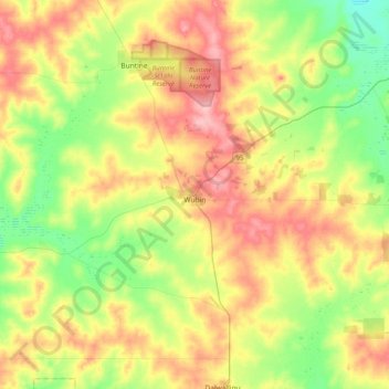
Name: Wubin topographic map, elevation, terrain.
Location: Wubin, Shire Of Dalwallinu, Western Australia, Australia (-30.19942 116.35336 -30.00501 116.75812)
Average elevation: 1,053 ft
Minimum elevation: 889 ft
Maximum elevation: 1,257 ft
Other topographic maps
Click on a map to view its topography, its elevation and its terrain.