
Snyder topographic map
Click on the map to display elevation.
About this map
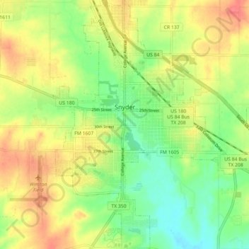
Name: Snyder topographic map, elevation, terrain.
Location: Snyder, Scurry County, Texas, 79549, United States (32.67536 -100.94383 32.75013 -100.85730)
Average elevation: 2,362 ft
Minimum elevation: 2,274 ft
Maximum elevation: 2,454 ft
Scurry County trails, hiking, mountain biking, running and outdoor activities
Other topographic maps
Click on a map to view its topography, its elevation and its terrain.