Geolocate

White Desert topographic map

Click on the map to display elevation.

About this map

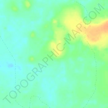
Name: White Desert topographic map, elevation, terrain.

Location: White Desert, New Valley, Egypt (27.28384 28.18521 27.30384 28.20521)

Average elevation: 52 ft

Minimum elevation: 13 ft

Maximum elevation: 128 ft

Other topographic maps

Click on a map to view its topography, its elevation and its terrain.

Toshka

Egypt > New Valley

Average elevation: 636 ft

Toshka

Egypt > New Valley

Average elevation: 646 ft

White Desert

Egypt > New Valley

Average elevation: 558 ft

Al Khargah City

Egypt > New Valley

Average elevation: 226 ft

Toshka Lakes

Egypt > New Valley

Average elevation: 531 ft

Toshka

Egypt > New Valley

Average elevation: 643 ft

Jouhayna City

Egypt > New Valley

Average elevation: 217 ft

Al Khargah City

Egypt > New Valley

Average elevation: 226 ft

Al Khargah City

Egypt > New Valley

Average elevation: 226 ft

Gear up for your next adventure:

🥘Titanium Cookware - Durable, featherlight pots and pans for backpacking
📱Heavy-Duty Phone Cases - Drop-proof and waterproof protection for outdoor navigation
🪓Survival Multi‑Tool - Versatile tool for camp and trail tasks
🧥Waterproof Jacket for Hiking - Breathable and rugged rain jacket for outdoor excursions
🧴Hand Sanitizer - Keep hands clean while hiking

As an Amazon Associate, this site earns from qualifying purchases at no extra cost to you.