Geolocate

Forest topographic map

Click on the map to display elevation.

About this map

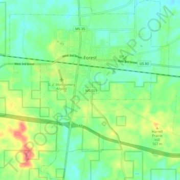
Name: Forest topographic map, elevation, terrain.

Location: Forest, Scott County, Mississippi, United States (32.31335 -89.52165 32.38880 -89.43514)

Average elevation: 476 ft

Minimum elevation: 404 ft

Maximum elevation: 620 ft

Scott County trails, hiking, mountain biking, running and outdoor activities

Other topographic maps

Click on a map to view its topography, its elevation and its terrain.

Sebastopol

United States > Mississippi > Scott County > Sebastopol

Average elevation: 413 ft

Gear up for your next adventure:

🥄Camping Utensil Set - Lightweight utensils for outdoor meals
🩹Survival Bandages - High‑quality bandages for emergencies
🌲Outdoor Survival Books - Best books on survival skills
🛌Ultralight Sleeping Bags - Compact down bags for cold nights in the wilderness
🪶Camping Sleeping Pad - Comfortable sleeping pad for backpacking

As an Amazon Associate, this site earns from qualifying purchases at no extra cost to you.