
Eigersund topographic map
Interactive map
Click on the map to display elevation.
About this map
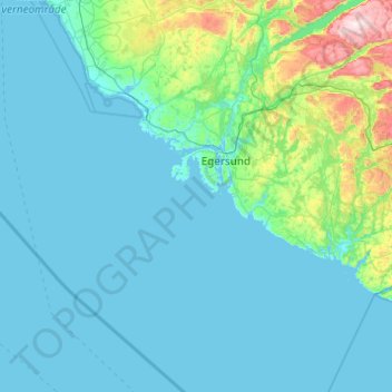
Name: Eigersund topographic map, elevation, terrain.
Location: Eigersund, Rogaland, Norway (58.15833 5.51954 58.64933 6.49750)
Average elevation: 289 ft
Minimum elevation: -3 ft
Maximum elevation: 2,943 ft
Other topographic maps
Click on a map to view its topography, its elevation and its terrain.