Geolocate

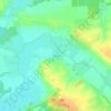
Puellemontier topographic map

Click on the map to display elevation.

About this map

Name: Puellemontier topographic map, elevation, terrain.

Location: Puellemontier, Rives Dervoises, Saint-Dizier, Haute-Marne, Grand Est, France métropolitaine, 52220, France (48.46819 4.65011 48.51094 4.73840)

Average elevation: 417 ft

Minimum elevation: 371 ft

Maximum elevation: 538 ft

Other topographic maps

Click on a map to view its topography, its elevation and its terrain.
Gervilliers

France > Grand Est > Haute-Marne > Rives Dervoises

Average elevation: 427 ft

Gear up for your next adventure:

🧼Biodegradable Camping Soap - Eco‑friendly soap for outdoor hygiene
🚗GPS Dash Cams - Record your scenic drives through mountain passes and canyons
🗻Climbing Gear Basics - Essential gear for beginner climbers
🎒Waterproof Dry Bags - Keep your electronics and maps dry inside your pack
🧭Map Reading Tools - Tools and kits for map navigation

As an Amazon Associate, this site earns from qualifying purchases at no extra cost to you.