Geolocate

Velim topographic map

Click on the map to display elevation.

About this map

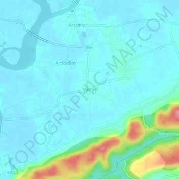
Name: Velim topographic map, elevation, terrain.

Location: Velim, Salcete, South Goa, Goa, 403723, India (15.14575 73.95425 15.18575 73.99425)

Average elevation: 59 ft

Minimum elevation: -3 ft

Maximum elevation: 351 ft

Other topographic maps

Click on a map to view its topography, its elevation and its terrain.

Sal

India > Goa > Salcete > Parlmar Grande

Average elevation: 49 ft

Gear up for your next adventure:

🛌Ultralight Sleeping Bags - Compact down bags for cold nights in the wilderness
🌲Outdoor Survival Books - Best books on survival skills
🏕️Tent Footprint - Protect your tent base from wear
🗺️Topographic Maps - Detailed topo maps for hiking, exploring and outdoor navigation
👖Convertible Hiking Pants - Versatile zip-off pants for changing altitudes and temperatures

As an Amazon Associate, this site earns from qualifying purchases at no extra cost to you.