
Make a donation
Gear up for your next adventure:
As an Amazon Associate, this site earns from qualifying purchases at no extra cost to you.
Asyut topographic map
Click on the map to display elevation.
Make a donation
Gear up for your next adventure:
As an Amazon Associate, this site earns from qualifying purchases at no extra cost to you.
Asyut
Köppen-Geiger climate classification system classifies its climate as hot desert (BWh). It is the driest city of Egypt. Luxor, Minya, Qena and Asyut have the widest difference of temperatures between days and nights of any city in Egypt, with almost 16 °C (29 °F) difference. The city of Asyut is sandwiched between two mountain ranges of about 600m height. There is also a lowering in elevation in mid Egypt, from the Mediterranean and the Red Sea. This gives the city and nearby towns and villages the similar properties of a continental climate, meaning that the city has harsh and chilly cold winter weather, and very hot but non-humid summers. During summer the temperature can exceed 42 °C (108 °F). Yet, in winter Asyut gets below 0 °C (32 °F) temperatures during the night and frost can easily form, while hail or snow are rare because of the low average of the city's precipitation and general low humidity.
Make a donation
Gear up for your next adventure:
As an Amazon Associate, this site earns from qualifying purchases at no extra cost to you.
About this map
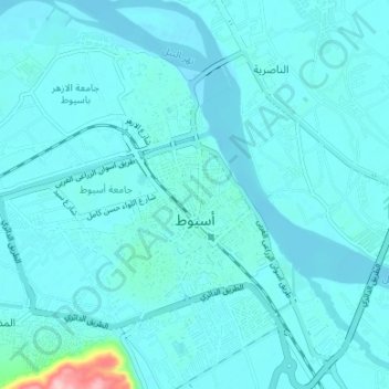
Name: Asyut topographic map, elevation, terrain.
Location: Asyut, Egypt (27.15725 31.14740 27.21658 31.21178)
Average elevation: 187 ft
Minimum elevation: 141 ft
Maximum elevation: 722 ft
Make a donation
Gear up for your next adventure:
As an Amazon Associate, this site earns from qualifying purchases at no extra cost to you.
Other topographic maps
Click on a map to view its topography, its elevation and its terrain.
Make a donation
Gear up for your next adventure:
As an Amazon Associate, this site earns from qualifying purchases at no extra cost to you.