
Gurdaspur topographic map
Click on the map to display elevation.
About this map
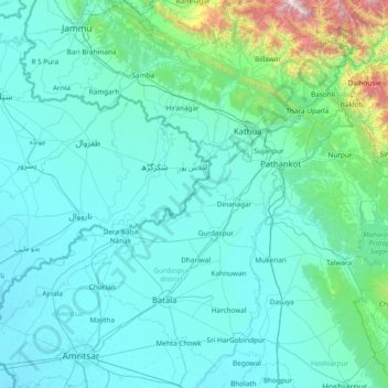
Name: Gurdaspur topographic map, elevation, terrain.
Location: Gurdaspur, Gurdaspur district, Punjab, 143525, India (31.46667 74.61667 32.86667 76.01667)
Average elevation: 1,667 ft
Minimum elevation: 699 ft
Maximum elevation: 14,049 ft
Other topographic maps
Click on a map to view its topography, its elevation and its terrain.